

























On a sunny afternoon, with bright skies and scattered clouds, I found myself admiring the beauty of Europe. A few days earlier, while travelling to our usual workplace at a place called ParQ54, which I will tell you more about another time, something unusual caught my attention.

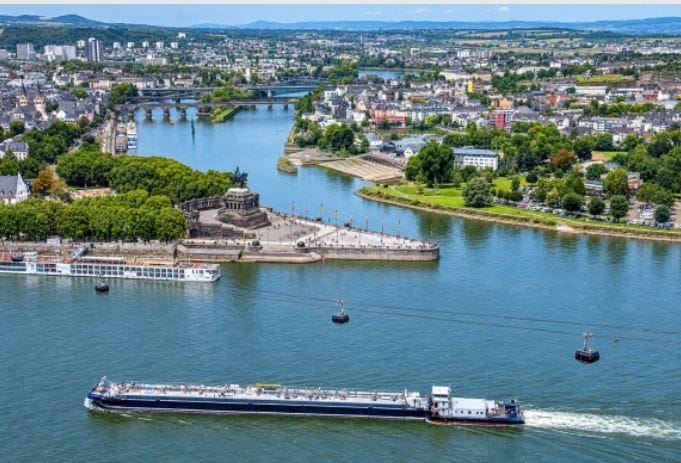
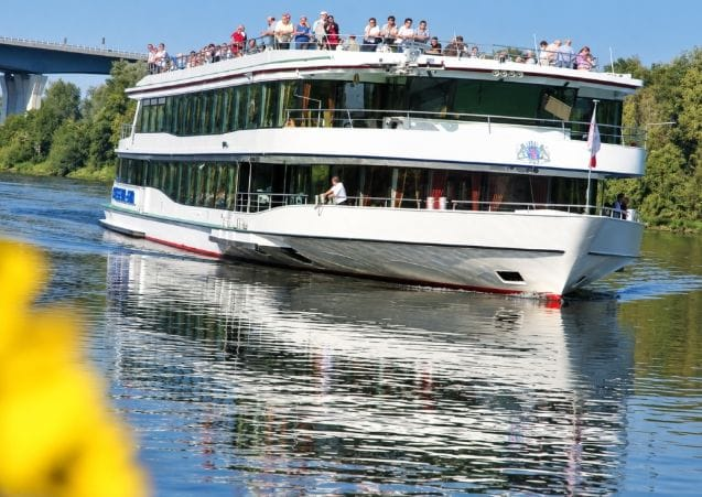
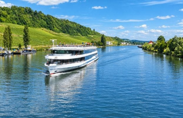
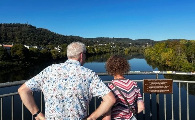
As we continued our journey, I noticed the calm waters and tourist boats passing one another. We were looking at the Moselle River, particularly the section flowing through Trier, Germany. The river passes through several countries, shaping the landscapes and communities along its banks.
Standing above the river was the Römerbrücke, a historic stone bridge supported by massive pillars firmly set in the water. Fascinated by its construction, I began asking my travelling companion, Luka Buntic, several questions.
My first question concerned the bridge’s history. Luka explained: “Römerbrücke means ‘Roman Bridge’ in German. Its stone pillars were first constructed around AD 144. Nearly 2,000 years have passed, yet the bridge is still used in the daily life of Trier. People and vehicles continue to cross the Moselle River on it,”
His explanation left me wondering how a bridge could remain standing after so many centuries. Historical records identify Trier as Germany’s oldest city, founded by the Romans in 16 BC. To strengthen the bridge, Roman engineers drove oak timber piles into the riverbed and surrounded them with solid basalt stones. This remarkable engineering achievement contributed to the bridge’s recognition as a UNESCO World Heritage Site in 1986.
I then asked Luka another question that many readers might also be wondering about: Why were so many major European cities established near rivers?
He smiled as we continued our journey. he explained: “Rivers such as the Moselle were not simply scenic attractions. In the past, they were essential to people’s lives. For example, the Moselle flows through France, Luxembourg and Germany, passing through Trier before joining the Rhine River at Koblenz. At that time, these rivers served as Europe’s major transport routes,” he explained.
His answer inspired me to research the Moselle and other European rivers. I discovered that their histories are closely connected to trade, statistics and economic development.
ALSO READ: https://agaciropress.com/celine-dion-falls-during-paris-concert-but-quickly-resumes-singing/
How Rivers Shaped European Trade
The Moselle is approximately 545 kilometres long. It rises in France’s Vosges Mountains, flows through Metz and reaches the Luxembourg border before passing through Trier and joining the Rhine at Koblenz.
From there, the Rhine, which is approximately 1,232 kilometres long, continues northwards, passing near Mainz and Cologne before reaching the Netherlands and flowing into the North Sea near Rotterdam. Together, the Moselle and Rhine form an extensive waterway network connecting inland communities with major European trading routes and the sea.
Before railways became widespread, waterways provided an important means of transporting goods such as wine and stone. Moving heavy cargo by river could be considerably cheaper than transporting it overland, making rivers valuable to merchants, towns and growing economies. I continued reflecting on this natural beauty and its economic significance. The thought stayed with me throughout the evening as we returned home from work at the park.
The following day, during our lunch break, I sat down for coffee and some reading with my colleagues Eliza and Christian Millen. I began telling them about the conversation Luka and I had shared.
After recounting the story, I said, “It seems to me that nearly every major European city was built near a river, and I believe this was a deliberate and well-planned decision.” Eliza replied, “That is easy to understand. It all comes down to trade and transportation. In the past, rivers were used to transport goods from one city to another. There were no aeroplanes or cars.”
Her explanation reflected a major factor in the historical growth of European cities: rivers offered transport routes long before modern road and rail networks developed. Examples of major cities established along rivers include Paris on the Seine, London on the Thames, Rome on the Tiber and Vienna on the Danube. These waterways helped connect settlements to agricultural regions, commercial centres and distant markets. Eliza continued, “For example, the Romans used the Moselle as one of their major transportation routes.”
Rivers Before the Romans
Christian Millen agreed, adding that the relationship between communities and rivers existed long before Roman rule. he said: “It was not just about trade. This practice existed even before the Romans arrived here. Celtic tribes, such as the Treveri, were already living along the banks of this river.”
Trier’s name is historically associated with the Treveri, an ancient Celtic people who lived in the region. Julius Caesar also wrote about the Treveri around 50 BC in his work De Bello Gallico (The Gallic Wars). Christian continued by explaining that rivers served purposes beyond transportation and trade.
he said: “In ancient times, access to clean drinking water was essential for human survival. Moreover, a river was not merely a transportation route; it also provided protection against enemies. Having a large body of water on one side made it more difficult for attackers to cross.”
Another colleague added, “A river could serve both as a defensive barrier protecting a settlement and as a transportation route.” The more I listened, the more I reflected on the different roles water plays in human life. Geography, climate and the characteristics of rivers can influence where people settle, how communities interact and how cities develop.
ALSO READ: https://agaciropress.com/bwiza-to-launch-third-album-home-in-zambia-alongside-bruce-melodie/
Why River Settlements Developed Differently Around the World
In Western Europe, navigable rivers flowing through valleys, including the Rhine, Seine and Moselle, helped connect cities and communities through trade and travel long before modern transport networks existed. Their economic value encouraged the growth of settlements around river crossings, ports and trading centres.
In sub-Saharan Africa, however, the relationship between rivers and settlement has varied considerably. Mountainous terrain, rapids, waterfalls and steep river sections can make navigation difficult in some areas. Parts of the Congo and Zambezi river systems, for example, contain major obstacles to continuous boat travel.
These conditions sometimes limited the use of rivers as uninterrupted transport routes. Nevertheless, rivers remained important sources of water, food, agricultural opportunities and trade. Many African communities also developed around lakes, fertile plains, coastlines and other locations suited to their needs.
Across the Atlantic, settlement patterns in the Americas developed under different historical and geographical circumstances. Ports played a major role in international trade and migration, contributing to the growth of cities such as New York and Boston. However, rivers also shaped the development of many American cities, including those built around inland waterways and river ports.
Ultimately, the relationship between rivers and cities cannot be explained by one factor alone. Access to water, transportation, trade, fertile land and defence all influenced where settlements developed. The history of the Moselle and the ancient bridge in Trier offers a striking example of how these natural features helped shape human civilisation over thousands of years.